Inca Trail
Pages and images tagged 'inca trail'
Images
Results 1-12 of 23
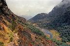
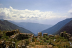
Inca Trail lake
Small lake and section of trail below the Abra de Runkurakay
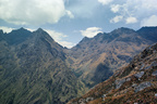
First pass
The Abra de Warmiwañusqa seen from the Abra de Runkurakay
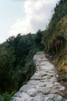
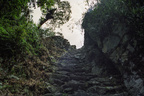
Inca roadway
Section of the Inca Trail near Sayacmarca
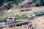
Ritual baths
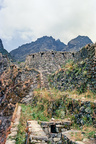
Ceremonial baths at Phuyupatamarca
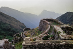
Ramparts at Phuyupatamarca
Looking out over the ruins of Phuyupatamarca
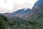
Lluchapampa
High-altitude grassland on the Inca Trail
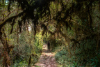
Cloud forest
Path through cloud forest near Sayacmarca
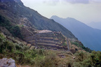
Phuyupatamarca
View of the Inca ruins at Phuyupatamarca
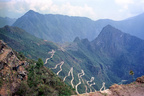
View from Sayacmarca
View of mountains with Sayacmarca ruins in foreground
Steps to Intipunku
Stairs leading to Intipunku
View from Intipunku
Machu Picchu and Hiram Bingham Highway seen from Intipunku
Ruins of Sayacmarca
Stairs and walls inside the ruins of Sayacmarca
Pages
Results 1-12 of 12
A sketch map of the Inca Trail to Machu Picchu in Peru.
Some notes about Incas and the history of the Inca Trail and Machu Picchu.
Information about alternative sites related to Machu Picchu and the Inca Trail and other tourist destinations in the region.
A virtual tour of the Inca Trail, a hiking route leading to the ruined city of Machu Picchu in Peru.
Some useful books about the Incas and the Inca civilization of Peru.
Some explanations of place names along the Inca Trail.
Day 1 of the Inca Trail, from Km.88 to Cusichaca.
Day 4 of the Inca Trail: to Intipunku and Machu Picchu.
Some frequently-asked questions about the Inca Trail to Machu Picchu in Peru.
Day 3 of the Inca Trail: from the Abra de Runkurakay to Phuyupatamarca.
Day 2 of the Inca Trail: from Cusichaca to the Pacamayo valley via the Abra de Warmiwañusqa.
Photographs taken on the Inca Trail to Machu Picchu in Peru.